I’ve been hiking in the desert for about 18 years now. I first followed routes from Schad’s “Afoot and Afield in San Diego County” and traveled with various friends from school or went out on my own. Some time ago I started hiking with Peter Thomas, who’s been my hiking partner now for about 14 years. Peter started planning trips by piecing together sections from guidebooks with sections that aren’t in any guidebooks, but looked like feasible routes from topo maps. Recently, we’ve been exploring a loop route from Sheep Canyon to Shingle Spring to Fig Tree Valley in the Anza Borrego Desert. This is a description of the trip this weekend.
This was our fourth time to this particular area and route. The first time we came in from Anza to the north using bicycles and a trailer to get to the start of the loop. On that trip we had a lot of trouble with the bicycles and, especially, the trailer getting stuck in the sand. It was long and exhausting and it was dark by the time we came out on the second day. The second time we came in from the mountains to the west. A ranger there warned us that a coming storm would make the access road impassible, so we shortened our hike to a day hike, making it to the saddle at the top of Sheep Canyon. The third time we came in again from the mountains. That trip was also long, and we ended up having to navigate our way out in the dark.
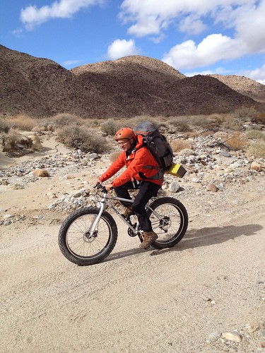
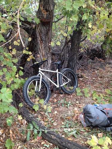
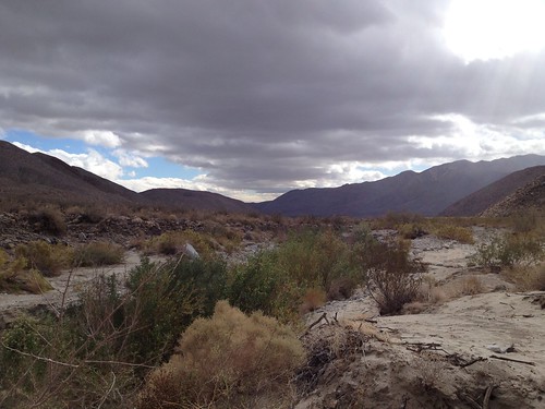
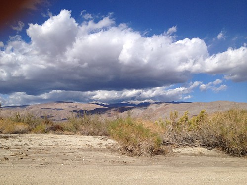
This trip was a reprise of the first trip using bikes to get the the trailhead but I was using a Surly Pugsley instead. The Pugsley has 4-inch diameter tires which allows it to travel through soft sand. The plan was for Peter to ride in Thursday night from the south, for me to head in Friday morning from the north, and we’d meet at Middle Willows. On Friday morning I drove to the top of Turkey Track in Anza and the end of a rocky dirt road. The forecast was for a storm to come in the next two days and deposit 1-3 inches of snow the first day and 3-5 the second. I was a little worried about the road getting muddy, but I guessed I could drive out after the storm. I parked and headed in to Coyote Canyon on the bike.
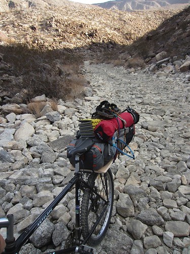
I didn’t set up the bike until the night before when I realized my rack wouldn’t fit over the tires, so I just rode wearing my pack. The Pugsley was great. It seemed made for this. I rode on jeep trails and through rocky washes all the way to Bailey’s Cabin in Fig Tree Valley without ever having to walk the bike. I did take one fall over the handlebars with a firm thud to my helmet (thank you, helmet), but otherwise it went smoothly.
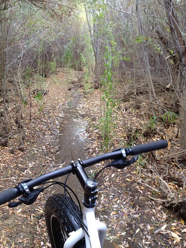
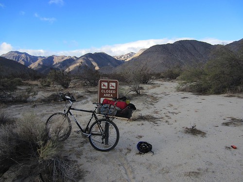
The next section of the canyon from Upper Willow to Middle Willows, two sections of dense vegetation, is an important desert bighorn sheep habitat and is closed to motor vehicles, so it was rougher going. I started down a wrong route in Upper Willows, got stuck, backed out, and found a route around the Willows. This was rocky and harder to navigate. I passed a monument to Juan Anza de Batista which seems to be in the middle of nowhere. I came to the Middle Willows which has a narrow path right through it. I started on the path, lost it, and got stuck. If I were on foot I could have pushed through the brush to pick up the path but not with the bike. I put the bike down and searched on foot for the path. After finding it I pushed the bike through to that path and followed it the rest of the way out. I came out the other side where Peter was waiting having come up from the south the day before.
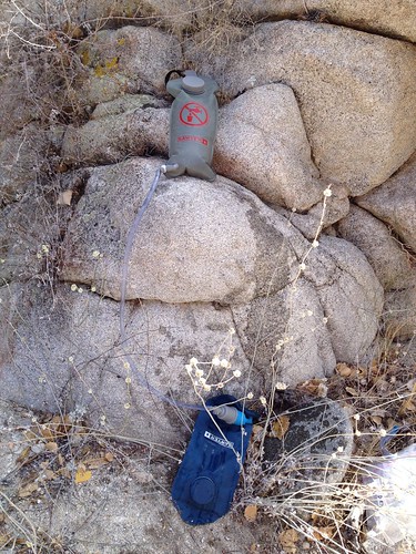
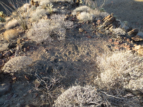
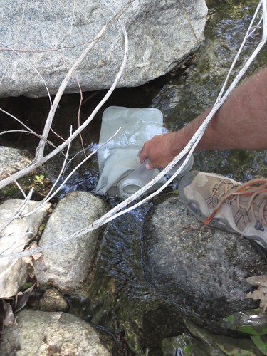
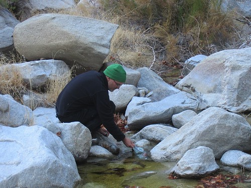
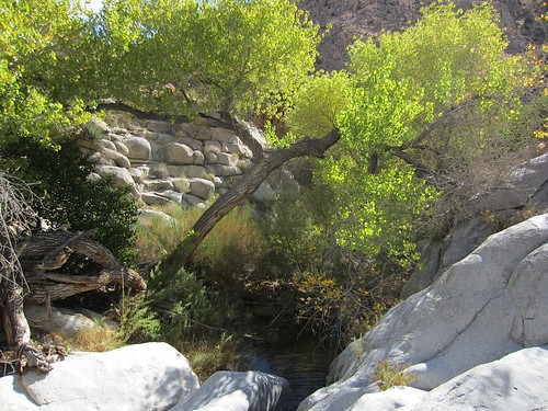
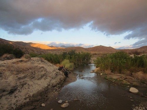
We filtered water there and headed over to Sheep Canyon on the bikes. We stowed the bikes at the head of the canyon and started hiking. Sheep Canyon has an annual stream in the upper reaches, but there was no water at the bottom. This is the case with all the streams in the desert. They start in the mountains, fed by a spring, run down a canyon, and then stop, usually before reaching the valley, absorbed back into the ground. It always seems odd to me for a stream to have two endpoints. Somehow I think they should be a line with only one dry endpoint. Although we were fairly sure we’d find water eventually in the upper reaches of the canyon, we couldn’t camp without it, so we decided we follow the stream bed for an hour, and, if we didn’t have water by then, re-assess. We did find water shortly.
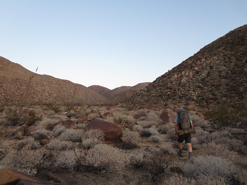
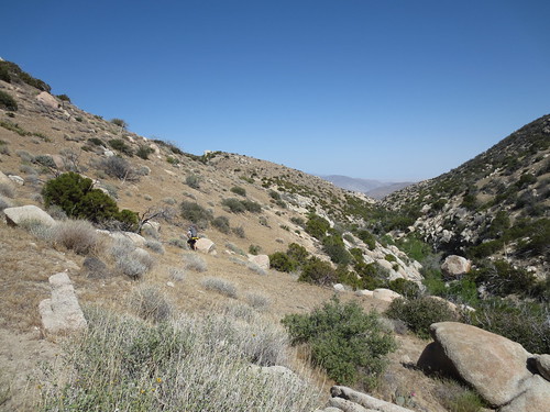
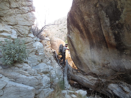
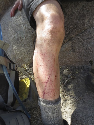
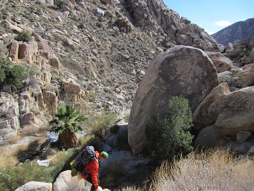
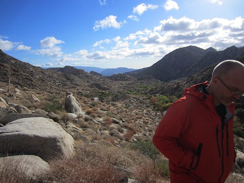
Traversing the canyon is slow going and involves a fair amount of scrambling over boulders and pushing through brush. The number of people who traverse these routes is small and drops off quickly the farther in you get. We typically don’t see anyone in the mountains on our trips (we didn’t this time). So even when there is a known route, there is no trail. Or, at least not a hiking trail like you typically imagine or see — a clear path with markings. Here and there you can find and follow thin signs of a trail. In some places it’s clear, but it inevitably disappears. It gets grown over, washed out, or breaks into separate routes. Following these spare trails is always an little emotional roller-coaster. There’s a high when you’ve found it and are following it and a let down when you lose it. When we lose it we usually push through and try to pick it up again. Sometimes the the trail will lead you around an impassible section in the canyon, like a drop-off or very dense brush, so it’s important to stay on it. We’ve gotten better over the years at following the trail, at picking up little signs of it, and being able to predict what routes they tend to follow. We take turns leading as it takes more effort to stay on the route and sometimes one or the other is doing better at it.
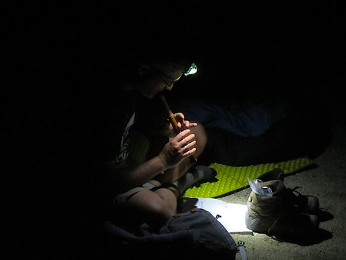
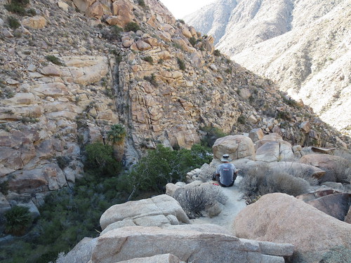
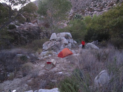
We made it to the lower reaches of a wide bowl near the top of the canyon and made camp. Somewhat coincidentally we found the same spot from a previous trip: a nice, flat, sandy spot near the stream. It was getting dark and cold as we set up the tents. We filtered more water, made dinner, and got to sleep. Nights are often long for me when hiking as we go to bed when it gets dark. I’ll sometimes get a lot of reading done (this time I picked up a book from our little library on the way out, which, so far, is pretty good). This time I slept pretty well and only woke a few times. It was a windy night and sand was blowing in under my rain fly and through the mesh tent. When I was reading I could feel the pages get gritty from the sand. Our tent pegs were set in the sand and not too firmly. I woke once to reset one when it blew loose letting the tent flap loudly in the wind.
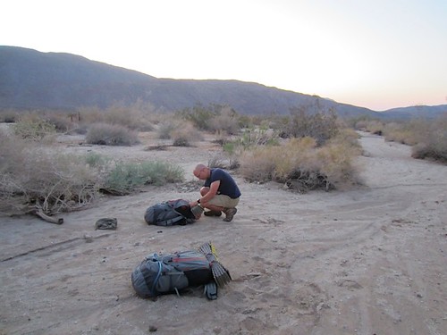
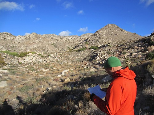
We try to pick sites that are close to water, are out of the wind, have enough space to pitch tents, and receive the morning sun, so as to warm us when we get up. But the choices are often restricted. This site didn’t receive morning sun, so it was cold when we got up. We tidied up, left our packs and tents, and headed up the canyon. We had had difficultly on previous trips finding the best route out of the top of the canyon, which involves some difficult climbing up steep, rocky slopes. Although we weren’t heading out that way this time, we wanted to scout out routes. We had a trail description from a book by Lindsey, but it was a little cryptic in this section. Even standing looking at the hills we weren’t quite certain of the right route. We settled on one that looked like the best candidate which we’ll try another time.
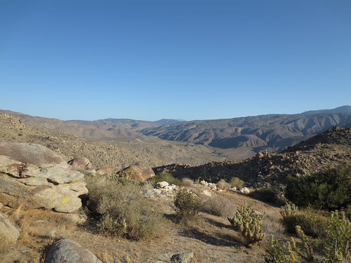
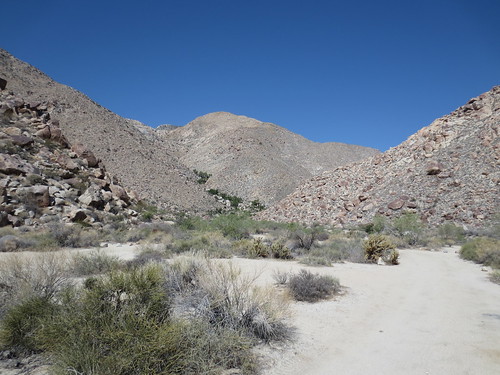
In the desert your view is seldom obscured by trees or foliage which allows you to pick out routes visually as you go along. Also, because the foliage is seldom dense at high elevations (away from water), if the slope of the terrain on a topo map is moderate, you can be relatively certain that you can traverse it. We use this to choose paths in unknown areas. However, you often have to choose an approach along a certain ridge line or canyon. As the ridges separate, if you weren’t careful in selecting your route, you can find yourself in an impassible section, on a ridge that has a sudden, steep drop off, or facing a cliff.
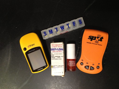
We bring a GPS on these trips but, since we’re not following a marked route, the GPS can only resolve where we are, not where we should be. We also bring a SPOT device. This can send a message at pretty much any location to a satellite, and we use it to send tracks of our route. It also allow you to send a call for help if need be. I started carrying it a few years ago after my third heart attack and after the boys were born. I also bring on every trip a small vial of nitroglycerin as well as extras of my heart meds. in case I have heart problems. I think the risk of having a heart attack on a trip is very small (it’s been 11 years since my last heart attack), but it’s always in the back of my mind when I’m in remote locations and far from medical help. In theory, if I had an attack, we could call for help with the SPOT and I can take a bunch of nitro., although I don’t know if extraction is possible in some canyons.
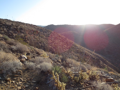
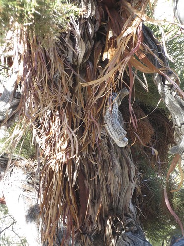
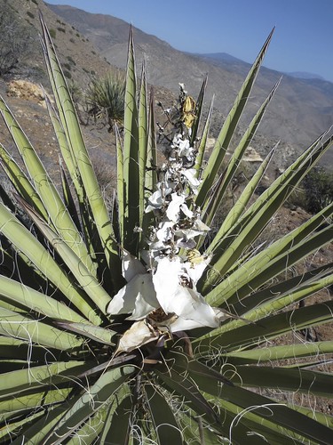
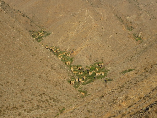
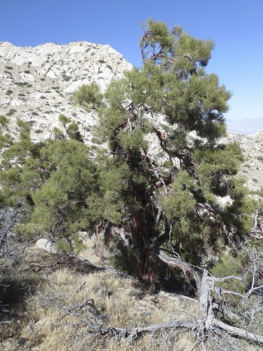
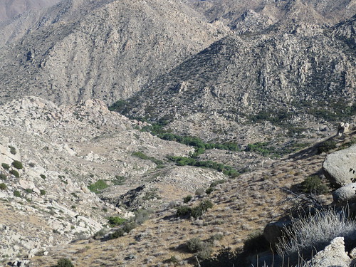
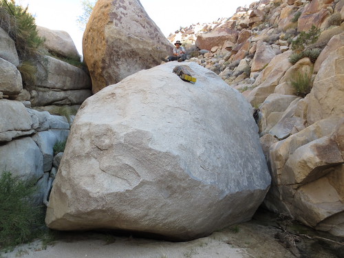
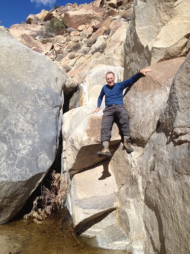
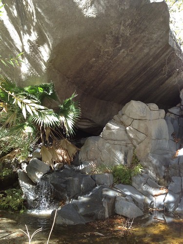
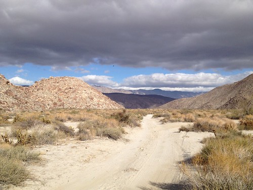
After finding what we thought was the right route out, we headed back to our camp, packed up, and started out down the canyon. These spring-fed desert canyons are simply beautiful. Around every corner is another striking spot essentially untouched by humans. There’s a stark contrast between the steep canyon walls with roughly hewn rocks, studded with agave and dry desert plants, and the canyon bottom, thick with palms, mesquite, catclaw, and water-loving brush. The boulders on the bottom of the canyon are typically larger, and smooth, carved by the water. In many spots the water carves out clear grooves and divots in the rock.
It often reminds me of the garden at the Getty museum in L.A. There’s a small man-made stream there that trickles down the hill making different sounds as it moves over varied surfaces. The streams here are what I imagine those man-made streams are emulating, and they’re much more compelling in their natural form. In every corner they create a new little picture, a new set of sounds.
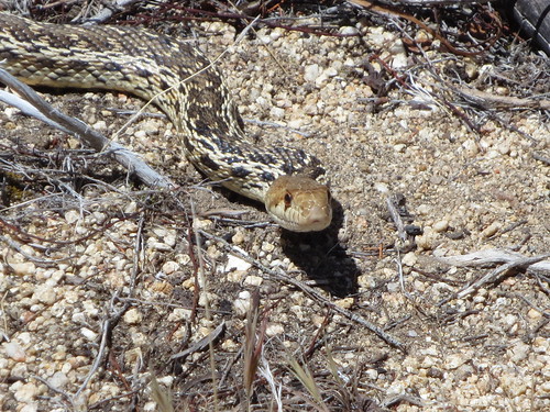
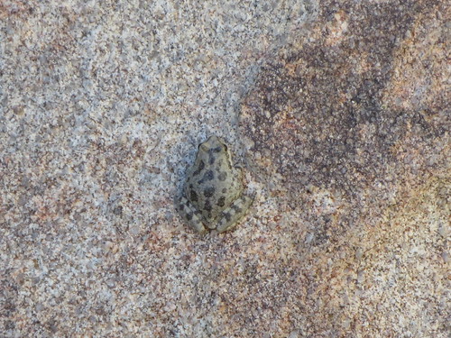
We always see some wildlife on the way although of course it’s relatively sparse. In the canyons, we always see birds and usually some frogs. We occasionally see snakes, probably one every trip, or every other trip. This time I stepped near a boulder, heard a rattle, and jumped aside. I never did see the snake. It’s unusual to be rattled at. It’s happened only about four times to me.
After a few hours of descending (always harder than ascending) we came out at the mouth of the canyon. As much as I love climbing in the mountains, I always have a feeling of relief on coming out. Route finding on the desert floor is relatively easy, and you’re not required to be constantly watching your footing. We picked up our bikes (my rear tire had a slow leak, so I pumped it up a bit) and headed out. On the way we passed a set of three four-wheel-drive vehicles heading in, and a lone hiker, also headed to Sheep Canyon. He gave Peter’s bike rig a thumbs up. Strapped to his pack was a small solar panel, which Peter asked about. It was a kit, and incorporated bamboo, which seemed to me to be the selling point for the hiker, who also sported a pair of bamboo hiking poles. He used it to charge his smart phone. He relayed the story of the maker, a young retired Silicon Valley millionaire, who, after making his millions, dropped out and started pursuing pet projects like this solar panel. We all nodded in agreement on the wiseness of this decision.
We rode the rest of the way out, carrying our bikes over three stream crossings. We finally came to Peter’s car, strapped our bikes to his rack and drove to Anza. The plan originally was for us to split up at Sheep Canyon and for me to head back North and come up via Turkey Track, but I decided it better not to travel alone, especially in such a remote area. It took longer than I anticipated for us to drive around to Anza. Peter couldn’t drive me all the way to my car, which was out on the end of a rocky dirt road. So he dropped me off and I got on my bike to ride the last section. I rode in a short way and ditched my pack on the side of the road, taking just my headlamp and car keys (double checked), so I could travel faster. The sun had just set and it was getting dark and cold.
At the end of a long trip there’s always a little pleasure in finally coming back to your car. And if you ever want to bond with your car, there’s no better way than to have it start up for you when you’re exhausted, all alone, in a cold dark remote location. It did start (I immediately forgave it any past offenses) and I drove out, stopping to pick up my pack. The storm had never materialized so I didn’t have to test my guess that I could still drive out if the road turned muddy.
Through Anza and part of the way back to Temecula I could only get AM talk radio and spanish FM. I listened to AM talk hosts lament the results of the election (“I’m telling Boehner-not one more dime of my tax dollars”) and discuss the minutia of college football.
Peter and I took a lot more photos. You can see a slideshow of them here.